1881 Census Geographical distribution maps
These maps were generated by "Surname Atlas" from this web site
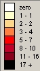
The colouring scale and the numbers shown signify the actual number of persons in the indicated poor-law areas at that time.:
View the maps in Adobe Acrobat format. You can donwload a reader from here if you havent it already installed.
For these maps poor-law areas were chosen because they are smaller than counties and therefore pin-point the concentrations more closely.
Click here to return to index page